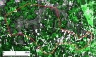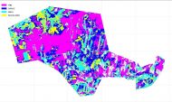
“Satellite remote sensing- based forest stock estimation technology (WoodStock)”
Agreement with Central Financing and Contracting Agency (CFCA) Nr.1.1.1.1/18/A/165
Scientific manager: Dr.sc.comp. Ints Mednieks (ints.mednieks@edi.lv).
Project objective: to develop a novel technology for the cost-effective estimation of forest stock volume based on high-resolution satellite remote sensing data.
The project is focused on the development of the prototype technology for estimation of forest stock volume from high-resolution satellite data, including methods for identification of tree species, estimation of tree height, estimation of forest density and estimation of forest stock volume from information about tree species, tree height and forest density.
The project is implemented by the Institute of Electronics and Computer Science in cooperation with company SIA “Baltic Satellite Service”.
Duration: 36 mēneši, from March 1, 2019 to February 28, 2022.
Planned cost: 498 026 EUR
25.07.2019. A progress report for the 1. phase (01.03.2019.g – 30.06.2019.g) has been submitted for the ERAF project “Satellite remote sensing- based forest stock estimation technology (WoodStock)” Agreement with Central Financing and Contracting Agency (CFCA) Nr.1.1.1.1/18/A/165.
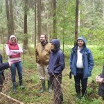
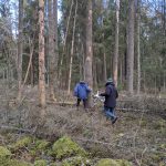
Project “Satellite remote sensing- based forest stock estimation technology (WoodStock)”. Discussion in the forest.
29.10.2019. A progress report for the 2. phase (01.07.2019.g – 30.09.2019.g) has been submitted for the ERAF project “Satellite remote sensing- based forest stock estimation technology (WoodStock)” Agreement with Central Financing and Contracting Agency (CFCA) Nr.1.1.1.1/18/A/165.
02.12.2019. Topical issues of the project implementation were discussed during the meeting of the scientific group of the project. General data processing scheme is developed. High resolution satellite data and field data procured. It was decided to continue research aimed at qualitative segmentation of forest areas.
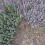
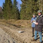
24.03.2020. Project “Satellite remote sensing- based forest stock estimation technology (WoodStock)”. Field data collection using UAV performed for the project in Daudzeses parish.
15.06.2020. Paper J.Sinica-Sinavskis, R. Dinuls, J. Zarins, I.Mednieks “Automatic tree species classification from Sentinel-2 images using deficient inventory data” submitted to conference BEC-2020.
29.06.2020. 10:00 Seminar of the European Union European Regional Development Fund project “Satellite remote sensing – based forest stock estimation technology (WoodStock)” Agreement with Central Financing and Contracting Agency (CFCA) Nr.1.1.1.1/18/A/165. Venue: Institute of Electronics and Computer Science, Dzerbenes str. 14, Riga.
27.08.2020. Paper J.Sinica-Sinavskis, R. Dinuls, J. Zarins, I.Mednieks “Automatic tree species classification from Sentinel-2 images using deficient inventory data” has been accepted for publication to conference BEC-2020.
10.09.2020. Topical issues of the project implementation were discussed during the meeting of the scientific group of the project. High-resolution WorldView images (including cloudy and smoky) will be processed according to a specific scheme. It was hypothesized that the VH polarization reflection intensities of ICEYE SAR data will correlate with forest density. It was decided to continue research aimed at qualitative assessment of forest stock.
28.10.2020. A progress report for the 4. phase (01.04.2020.g – 30.09.2020.g) has been submitted for the ERAF project “Satellite remote sensing- based forest stock estimation technology (WoodStock)” Agreement with Central Financing and Contracting Agency (CFCA) Nr.1.1.1.1/18/A/165.
25.11.2020. Canopy height models created from stereo satellite multispectral and SAR data.
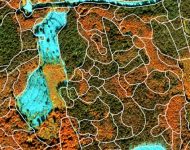
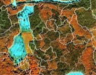
23.02.2021. Paper “Automated delineation of microstands in hemiboreal mixed forests using GeoEye-1 data and a JSEG-based workflow” submitted for publication.
Manually delineated microstands Automated delineation of microstands
29.06.2021. 10:00 Seminar of the European Union European Regional Development Fund project “Satellite remote sensing – based forest stock estimation technology (WoodStock)” Agreement with Central Financing and Contracting Agency (CFCA) Nr.1.1.1.1/18/A/165. Venue: Institute of Electronics and Computer Science, Dzerbenes str. 14, Riga.
28.10.2021. A progress report for the 6th phase (01.04.2021.g – 30.09.2021.g) has been submitted. It contains technology prototypes for the creation of a canopy height model and estimation of forest density/ cross-section.
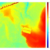
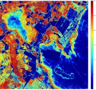
DTM CHM
10.11.2021. Remote assessment of the project status performed by the contracting agency CFCA.
19.01.2022. Developed stand volume estimation algorithms and their results were presented to the speciālists of JSC Latvia’s State Forests (LSF) during the online meeting organized by LSF.
Publications
J.Sinica-Sinavskis, R. Dinuls, J. Zarins, and I. Mednieks, “Automatic tree species classification from Sentinel-2 images using deficient inventory data,” 2020 17th Biennial Baltic Electronics Conference (BEC), Tallinn, Estonia, 2020, pp. 1-6, doi: 10.1109/BEC49624.2020.9276810.
Grigorijs Goldbergs “Impact of Base-to-Height Ratio on Canopy Height Estimation Accuracy of Hemiboreal Forest Tree Species by Using Satellite and Airborne Stereo Imagery “ MPDI Open Acces Journals. 27 July 2021. https://www.mdpi.com/2072-4292/13/15/2941 , Remote Sens. 2021, 13(15), 2941; https://doi.org/10.3390/rs13152941
Linda Gulbe, Ints Mednieks “Estimating Stand Volume at Microstand Level Using High Spatial Resolution Satellite and Lidar Data” INTERNATIONAL SYMPOSIUM ON APPLIED GEOINFORMATICS (ISAG2021) 2-3.December 2021 Riga, Latvia; https://isagsymposium.org/index.php
Linda Gulbe, Juris Zarins, Ints Mednieks, “Automated delineation of microstands in hemiboreal mixed forests using stereo GeoEye-1 data”. MPDI Open Access Journals., Remote Sens. 18 March 2022.

